Subject: Puerto Rico
Period: 1898 (dated)
Publication:
Color: Printed Color
Size:
28.7 x 21.1 inches
72.9 x 53.6 cm
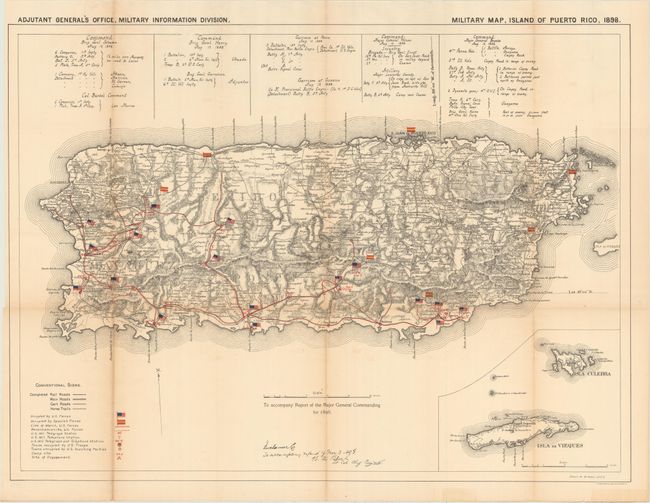
This attractive Spanish American War map uses colored flags to show the location of U.S. and Spanish forces. The map itself is uncolored so the colorful overprinted flags appear nearly three dimensional on the sheet. Details include scores of towns and villages, roads, railroads, cart roads, and horse trails. The hills and mountains are shown in extensive hachure. Above the map is a comprehensive listing of all military deployments with the commanding officer named. Large inset map at lower right details the Isla Culbra and Isla de Vieques. Signed in the plate by W.M. Black, Lt. Col. Chief Engineer. Drawn by W. Morey Jr., C.E. and published by the Adjutant General's Office, Military Information Division. A desirable and detailed Spanish American War map that is drawn on the scale of 1 inch to 4 miles.
References: Phillips (M) p.720.
Condition: B
Light toning along a few folds with some supporting archival tape on verso.