Subject: Cap Haitien, Haiti
Period: 1786 (dated)
Publication:
Color: Hand Color
Size:
23.4 x 16.8 inches
59.4 x 42.7 cm
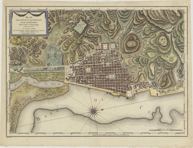
This superb bird's-eye plan depicts the important port city of Cap Francois on the island of Saint Domingue, now known as Cap Haitien, Haiti. Saint Domingue was a French colony established on the island of Hispaniola in 1659, and Cap Francois, established circa 1670, was the capital. This plan shows the block-street pattern in detail, with streets named and important locations identified. Just outside the city is a "bazaar for the sale of Negros." The city is surrounded by excellent topographical detail. A large compass rose orients north to the right, and the map is embellished with a title cartouche featuring a garland. Engraved by Dupuis. This map is very rare and seldom appears on the market.
References:
Condition: A
Excellent impression and color on sturdy, watermarked paper with marginal soiling.