Subject: Cuba & Jamaica
Period: 1598 (circa)
Publication: Histoire Universelle des Indes Occidentales et Orientales
Color: Hand Color
Size:
11.3 x 9 inches
28.7 x 22.9 cm
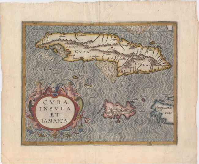
This is one of only two Caribbean maps in this important work, which was the first atlas dedicated to the New World. It provides an important, early view of Cuba and Jamaica with the Cayman Islands located between them. A bit of Hispaniola is also included. Even though Cuba was among the earliest European discoveries in the region, the cartographic information disseminated was often incorrect and confusing. It was not until Ortelius' map of 1579 that Havana was correctly shown on the north coast, even though it had been founded in 1514 by Spanish conquistadors and named after a local Indian chief, San Cristobal de Habana. This map shows Havana in the correct location but also includes St. Christophori in its primitive location on Cuba's southwestern coast. The handsome map is embellished with a large strapwork title cartouche and a fully engraved moiré-patterned sea.
References: Cueto #16; Kapp (MCC-42) #5.
Condition: A
A good impression on watermarked paper with attractive color, several minor printer's creases, and a small, professionally repaired worm hole along centerfold near bottom.