Subject: West Indies, Atlantic Islands
Period: 1835-36 (dated)
Publication:
Color: Hand Color
The beginning of the nineteenth century saw a period of rapid market growth and innovation in the map publishing world. Increased literacy and public interest in new frontiers and colonies overwhelmed the market because it was oriented toward the small, affluent market of the previous century. With the intent to fill this void, The Society for the Diffusion of Useful Knowledge (SDUK) was founded in 1828 in London, by Lord Brougham and a group of men dedicated to the education of the aspiring working class and the Utilitarian ideal of 'Knowledge is Power.' The society produced an array of education materials, but the series of maps was one of their most successful ventures. A number of engravers and printers were used to produce the maps, which eventually exceed 200 sheets, and continued to be published after the Society as a whole ceased to function.
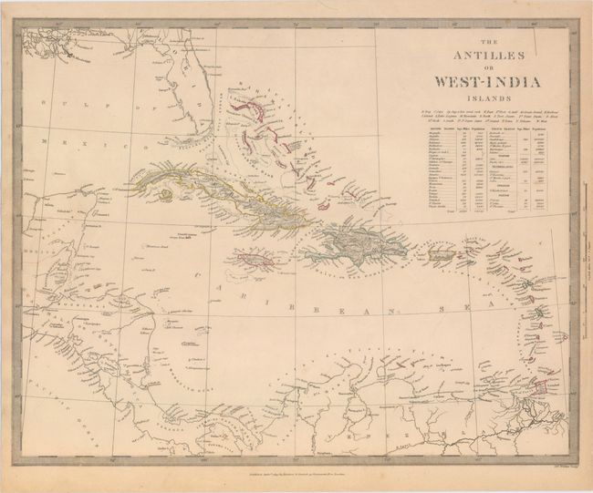
A. The Antilles or West-India Islands, dated 1835 (15.5 x 12.3"). Very detailed map of the entire Caribbean and Bahamas showing the islands and colored to reflect the colonial possessions. Statistics providing area and population are printed under the title.
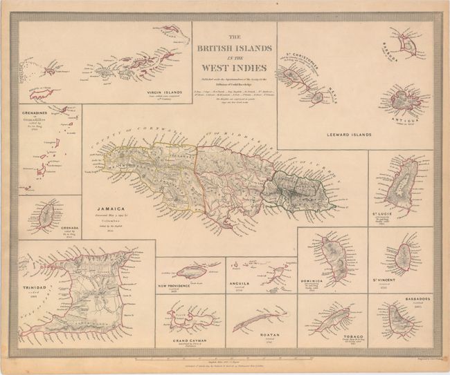
B. The British Islands in the West Indies, dated 1835 (15.7 x 12.5"). This map features Jamaica at its center, surrounded by 14 insets of other islands. Includes charts of the Leeward Islands, the Virgin Islands, Grenadines, Granada, Trinidad, New Providence, Anguila, Dominica, St. Vincent, St. Lucie, Barbados, Tobago, Roatan, and Grand Cayman.
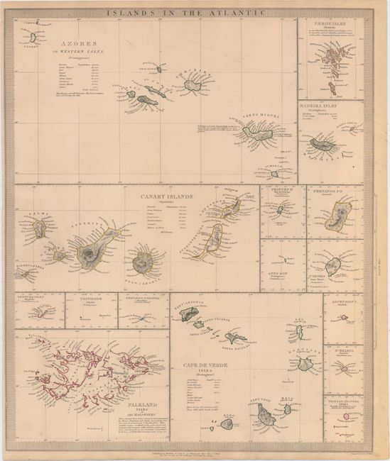
C. Islands in the Atlantic, dated 1836 (12.9 x 15.7"). A group of 16 insets display the various islands in good detail. The larger insets feature the Azores, the Canary Islands, the Cape de Verde Isles, and the Falklands; others show Bermuda, St. Thomas, St. Helena and Trinidad.
All published by Baldwin and Cradock and engraved by J. & C. Walker.
References:
Condition: B+
Original color with light overall toning as is typical for SDUK maps. The Atlantic Islands map has a narrow left margin.