Subject: Panama
Period: 1802 (dated)
Publication:
Color: Hand Color
Size:
17.1 x 12.9 inches
43.4 x 32.8 cm
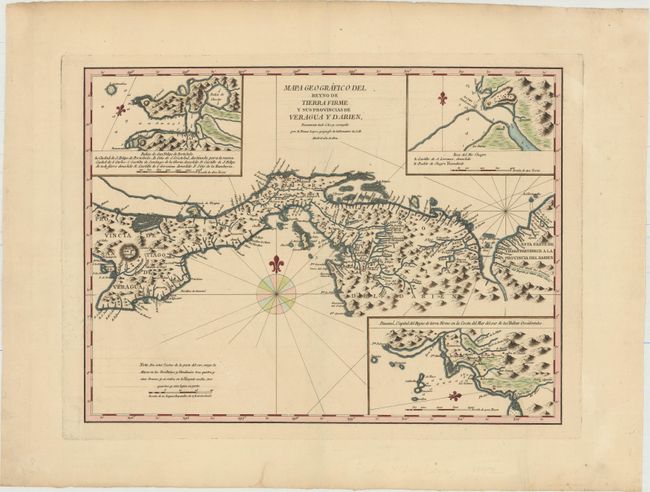
This scarce map was published by one of the most distinguished Spanish cartographers of the eighteenth century, Lopez de Vargas Machuca (1730-1802), who was Geographer to the King of Spain. The map extends from the Azuero Peninsula to the northwestern tip of Colombia, and features numerous towns, rivers, and mountains. Three inset maps show soundings and navigational detail of areas along the coast: the bay and port of Portobelo; the mouth of Chagres River; and the area surrounding Panama City. A very rare map, as few Spanish maps were ever published. We were not able to find any examples of this map being offered for sale in the last 30 years.
References: Kapp (MCC-73) #92.
Condition: A
A strong impression on watermarked paper ("A Z") with wide margins. There is a minor printer's crease and marginal soiling.