Subject: World
Period: 1838 (dated)
Publication: Atlas Universel
Color: Hand Color
Size:
21.7 x 15.8 inches
55.1 x 40.1 cm
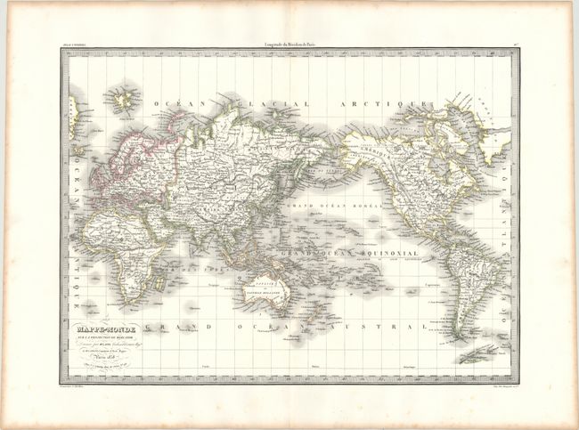
This attractive map of the world shows the western hemisphere to the right of the eastern hemisphere. There is nice topographical detail, and cities, rivers, and hundreds of islands are identified, including several newly discovered archipelagoes in the Pacific. Australia appears with an accurate coastline and a detached Tasmania. A sliver of Antarctica's coastline is located to the south of South America. America's Pacific Northwest coast and Alaska have also been explored and charted. Engraved by Pierre Tardieu.
References:
Condition: A
Original outline color on a clean, bright sheet with a few tiny holes in the map image that are only visible when held up to light and marginal toning and foxing.