Catalog Archive
Auction 152, Lot 286

"Carte des Republiques Unies du Mexique", Heck, Johann Georg

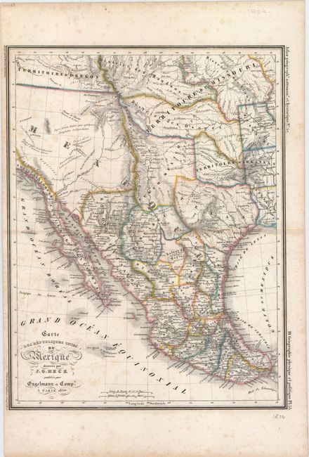
Subject: Southwestern United States & Mexico

Period: 1834 (dated)

Publication: Atlas Geographe. Astronome. Et Hystorique

Color: Hand Color

Size:
10.1 x 13.2 inches
25.7 x 33.5 cm
Download High Resolution Image
(or just click on image to launch the Zoom viewer)

Attractive map covering present-day Mexico and the southwestern United States up to the 44th parallel. Mexico is divided into states and includes Texas. The map shows routes from Natchitoches and Austin to points south, as well as several trails leading to Santa Fe. The mythical Lake Teguayo is shown below Lake Timpanagos with several notations in the Great Basin including "desert country, inhabited by few" and "country of many free Indian tribes." Fancy titling and two distance scales.

References:

Condition: B

A sharp impression with light scattered foxing.

Estimate: $230 - $275

Sold for: $120

Closed on 2/18/2015

Archived