Subject: Southwestern United States & Mexico
Period: 1825 (circa)
Publication:
Color: Black & White
Size:
12.6 x 17.9 inches
32 x 45.5 cm
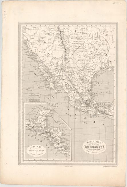
This map depicts Mexico extending north to the 42nd parallel and east to the Sabine River as established by the Adams-Onis Treaty of 1819. The name Texas does not appear on the map with only a few place names identified in the region including San Antonio, San Felipe and Nacogdoches. Arkansas, Missouri, Kansas, Louisiana and Mississippi are noted but not delineated on the map. The western topography is represented in hachure and is based on the expeditions of Lewis and Clark, Pike and Long. Includes an inset of Central America at bottom left. Engraved by Grenier.
References:
Condition: A
On a clean sheet with an edge tear at bottom confined to the blank margin.