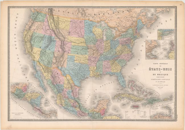
Subject: United States & Mexico
Period: 1875 (dated)
Publication: Atlas Universel
Color: Hand Color
Size:
35.5 x 24.3 inches
90.2 x 61.7 cm
This is an attractive, large 19th century map of the United States, Mexico and the West Indies with insets of Central America, Lesser Antilles, New York, and Atlantic travel and cable routes. The most interesting feature of the map is the odd configuration of California and Nevada, which resulted from a misunderstanding of the boundary changes that occurred when Arizona ceded land west of the Colorado and Virgin rivers to Nevada in 1866. This map shows the Nevada/Utah border too far west and the ceded region belonging to California instead of Nevada. Also, West Virginia is still a part of Virginia despite the 1875 date. The overland routes to Santa Fe, Mexico and California are noted as well as notations of native tribes and topography. A color key at bottom identifies the colonial possessions. The map is printed on two joined sheets.
References:
Condition: A
There is some light toning in the blank margins, else fine.