Subject: Yellowstone, Wyoming
Period: 1901-04 (circa)
Publication:
Color:
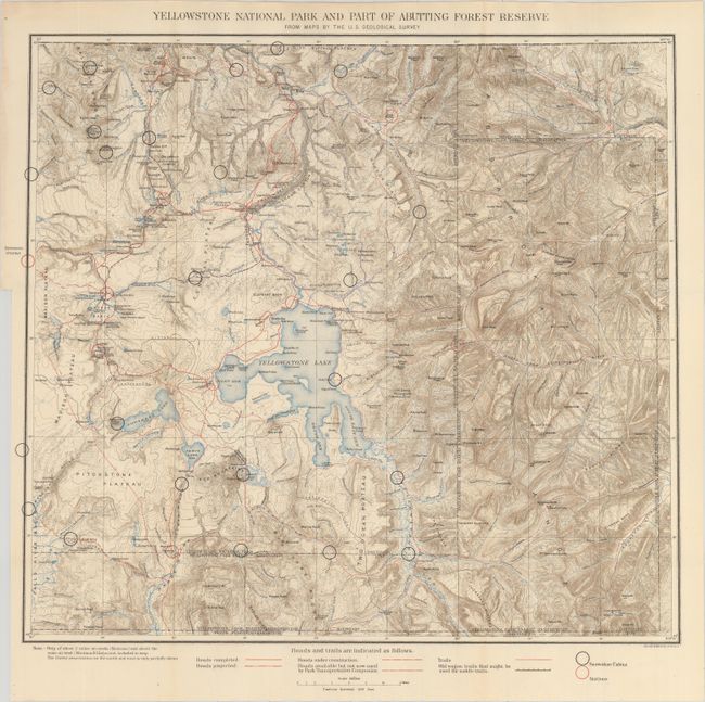
A. Yellowstone National Park and Part of Abutting Forest Reserve from Maps by the U.S. Geological Survey, by U.S. Geological Survey (USGS), circa 1904, printed color (19.9 x 17.9"). This beautifully colored topographical map was issued by the Park Superintendent after maps by the U.S. Geological Survey. It shows the entire park in great detail at a scale of four miles per inch. Legend identifies ranger stations, snowshoe cabins, existing roads, unused roads, trails and more. It locates the remote Shoshone, Lewis and Heart Lakes; names the Upper, Shoshone, Gibbon, and Heart Lake Geyser Basins, Mud Geysers, Mammoth Hot Springs and more. There is terrific detail of topography with contour intervals at 100 feet, watershed and numerous features.
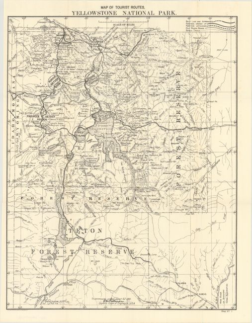
B. Map of Tourist Routes, Yellowstone National Park, by U.S. Corps of Engineers, dated 1901, black & white (16.3 x 20.8"). This is the map a tourist would have seen at the turn of the 20th century. It show the entire park with all roads, geyser basins and other information important to the visitor. Legend further identifies old wagon roads, bridle trails, and more. From Capt. H.M. Chittenden's report on development of the park in 1902.
References:
Condition: A+
Issued folding.