Subject: Yorktown, Virginia
Period: 1788 (circa)
Publication: The History of Rise, Progress and Establishment of the…United States
Color: Black & White
Size:
8.5 x 11.3 inches
21.6 x 28.7 cm
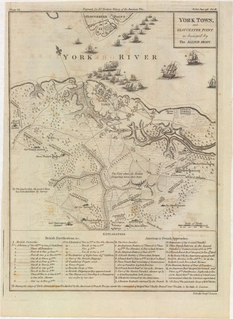
This finely engraved map provides information on this important American Revolutionary War battle including the positions of British, American and French troops, and the ships in the York River. Good detail including many villages, roads, watershed, forests, and topographical information. Locates with tent icons the quarters of Count Rochambeau, Gen. Washington, Gen. Knox, Gen. Nelson, Gen. Clinton, and several French commanders. Names Moore's House and delineates the roads to Williamsburg and to Hampton. The lower quarter of the map is a key that names and locates 22 British Fortifications and 15 French and American "Approaches". North located by a fleur-de-lis in the York River. Plate IX at upper left above neatline. Published in William Gordon's The History of Rise, Progress and Establishment of the Independence of the United States.
References: Howes #G256.
Condition: B+
Issued folding with light offsetting, a few spots of foxing, and a binding trim at top left replaced with old paper.