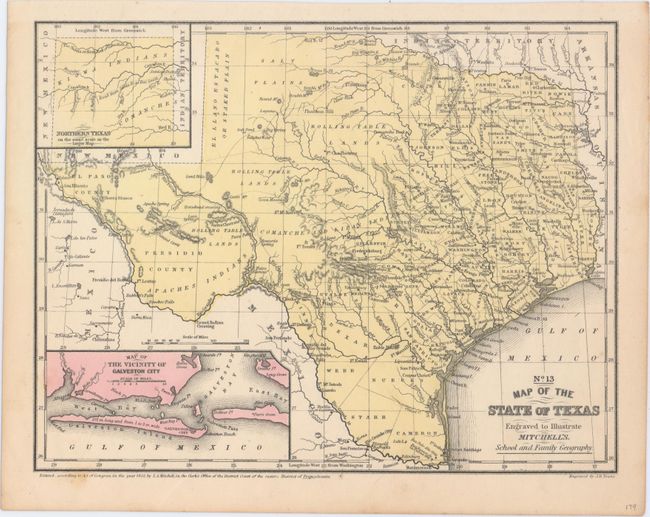
Subject: Texas
Period: 1852 (dated)
Publication: Mitchell's School and Family Geography
Color: Hand Color
Size:
10.6 x 8.1 inches
26.9 x 20.6 cm
Fine map of Texas filled with a remarkable amount of information for a school atlas map. Details include Indian tribes, watershed, counties, cities and towns, wagon roads or trails, and more. There are no counties formed west of the 101st meridian. The Salt Plains lay to the east of the Staked Plain, and much of central Texas is labeled Rolling Table Lands. The hills are shown through hachure. With insets of the panhandle and the vicinity of Galveston. The county development is consistent with 1854 with the newly formed counties of Hill, Madison, and Burnet, although Hidalgo county does not appear, despite being organized in 1852.
References:
Condition: A
One tiny spot along the lower border, else fine.