Subject: World
Period: 1781 (circa)
Publication:
Color: Black & White
Size:
17.1 x 10.6 inches
43.4 x 26.9 cm
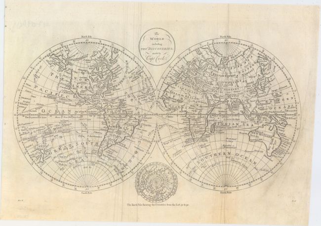
This attractive double-hemisphere world map depicts the voyages and discoveries of Captain James Cook. Alaska is shown with a fairly correct shape with a notation along its northern coastline, "according to the Japanese." The Sandwich Islands are shown and noted as the place where Capt. Cook was killed. The South Pacific is filled with islands, and New Zealand is fully formed. Tasmania is still attached to Australia, which is shown with an unexplored coastline between Lewins Land and Diemens Land. There are numerous notations throughout and the tracks of Cook's three voyages. An inset of the North Pole, showing a less developed Alaska, is tucked between the hemispheres at bottom with the title cartouche balancing the composition at top.
References:
Condition: B+
Issued folding with some extraneous creasing, faint soiling, and several short tears along the right fold that have been professionally repaired.