Catalog Archive
Auction 152, Lot 249

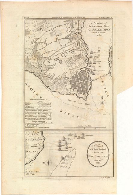
"A Sketch of the Operations Before Charlestown, South Carolina. 1780 [on sheet with] A Sketch of Sr. Peter Parker's Attack on Fort Moultrie, June 28th 1776.", Conder, Thomas

Subject: Charleston, South Carolina

Period: 1788 (circa)

Publication: The History of Rise, Progress and Establishment of the…United States

Color: Black & White

Size:
6.6 x 11.5 inches
16.8 x 29.2 cm
Download High Resolution Image
(or just click on image to launch the Zoom viewer)

Includes two detailed Revolutionary War maps in the vicinity of Charlestown. The larger plan shows the second siege of Charleston in 1780 with 16 keyed American fortifications. British approaches are shown in the Cooper River including 10 large ships and several smaller ones creating a blockade in the river. The smaller plan at bottom shows the Battle at Sullivan’s Island (or the first siege of Charleston) and the Briitish’s unsuccessful naval attack on Fourt Moultrie. Published in William Gordon's The History of Rise, Progress and Establishment of the Independence of the United States.

References: Howes #G256.

Condition: B+

Issued folding with faint offsetting, a few spots of foxing, and a binding trim at lower right.

Estimate: $350 - $425

Sold for: $250

Closed on 2/18/2015

Archived