Subject: Oklahoma
Period: 1910 (published)
Publication: Sen. Ex. Doc. 390, 61st Congress, 2nd Session
Color: Printed Color
Size:
9.2 x 6 inches
23.4 x 15.2 cm
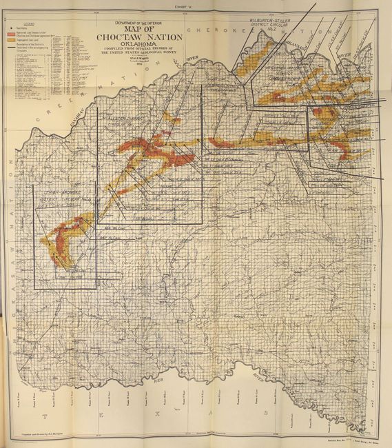
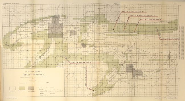
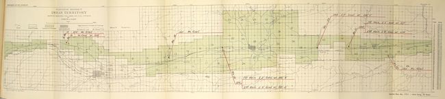
This Senate document contains a group of reports to determine the extent and value of coal deposits in and under the segregated coal lands of the Choctaw and Chickasaw nations in Oklahoma. Included with the 374 pages of text are 10 district maps as well as the large folding Map of Choctaw Nation Oklahoma (24.3 x 28"). The map serves as the index to the smaller district maps and shows approved coal leases, segregated coal land and test holes. A table at top left identifies the names of the mining companies operating the leases. Drawn by R.L. McAlpine. Hardbound in beige cloth.
References:
Condition: A
Condition code is for the maps which are clean and bright with occasional faint toning along the folds and a few short binding tears. Text is clean and tight. Front hinge is starting. Covers are lightly soiled with minor wear.