Subject: Oklahoma
Period: 1898 (published)
Publication:
Color: Printed Color
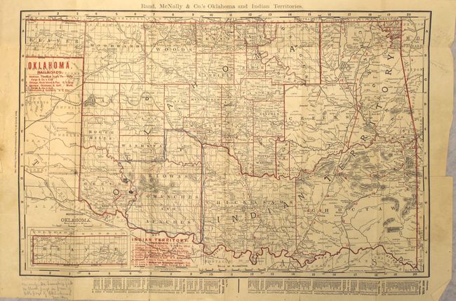
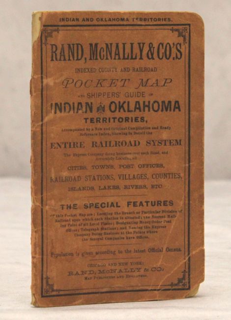
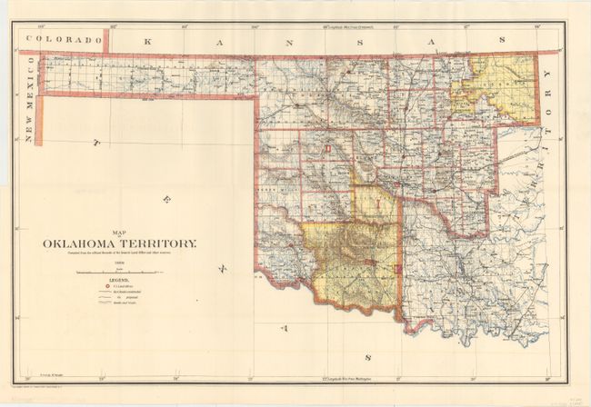
This nice pair of maps focuses on the Oklahoma Territory. Both were published in 1898. The first is colored in outline to delineate counties and to show twelve railroads listed in red overprinting. The extreme western portion of Beaver County is in an inset at lower left. A hand-written marginal note states that the location of Altus is not accurate. The writer also outlines an area in blue pencil. Folds into stiff paper wrappers, including title pages and railroad index for each territory. The second folding map is a fine example of the 1898 General Land Office issue that accurately shows the location of Altus. This map shows U.S. Land offices, railroads constructed and those proposed, plus roads and trails throughout the territory.
A. Rand, McNally & Co.'s Oklahoma and Indian Territories, by Rand McNally & Co., published 1898 (19.1 x 12.3"). Condition: Issued folding with the aforementioned manuscript notations, a short binding tear in the left blank margin, a few small splits at fold intersections, and some short edge tears, only one of which enters the neatline, at right. The wrappers are worn. (B)
B. Map of Oklahoma Territory. Compiled from the Official Records of the General Land Office and Other Sources, by General Land Office, dated 1898 (21.9 x 14.3"). Condition: Issued folding with minor offsetting, a couple insignificant spots, and a binding trim in the left blank margin. (A)
References:
Condition:
See description above.