Subject: Oklahoma
Period: 1893 (dated)
Publication: House Doc. #27, 53rd Congress, 1st Session
Color: Black & White
Size:
32.5 x 19.9 inches
82.6 x 50.5 cm
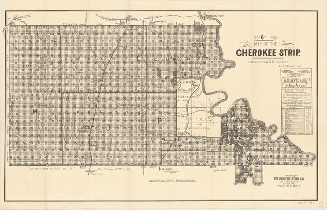
The Cherokee Outlet, about 12,000 square miles in present-day western Oklahoma, was purchased from the Cherokee in 1861. On September 16, 1893, it was opened for settlement with over 100,000 settlers braced on the opening lines. This map details the parcels available at $2.50 and $1.50 per acre. It locates the seven starting booths, plus the railroads, villages and towns, and topographical and watershed information. The reserved Cherokee Allotments are marked on the map in black. This remarkable document illustrates one of the greatest land rushes in history. Published by Western Litho. Co., Wichita, Kansas.
References:
Condition: A
A crisp impression, issued folding, now backed with archival tissue, with just a touch of soiling at bottom left.