Subject: Oklahoma
Period: 1879 (dated)
Publication: Senate Doc. #20, 46th Congress, 1st Session
Color: Printed Color
Size:
22 x 15.2 inches
55.9 x 38.6 cm
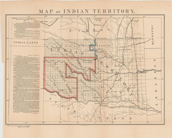
A desirable map depicting the territory with the first designation of Public Lands. Included in a panel to the side of the map are two fascinating letters concerning the disposition of the Public Lands within the territory. The first, by Congressman Augustus Albert contains a list of questions. The answers, by Col. E.C. Boudinot, attempt to "set the records straight" by detailing how the land was acquired from the Indians, its current status, and directions to "several million acres of the richest land on the continent." A number of Army forts are named and located. A significant and important map for any Oklahoma collection.
References:
Condition: A
Issued folding with an edge tear at right that enters about 0.5" into the image and has been closed on verso with archival tape, as well as a few short fold separations, nearly all of which are confined the blank margins. There is a binding trim in the left margin.