Subject: New York
Period: 1894 (dated)
Publication:
Color: Hand Color
Size:
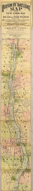
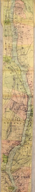
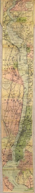
5.4 x 107 inches
13.7 x 271.8 cm
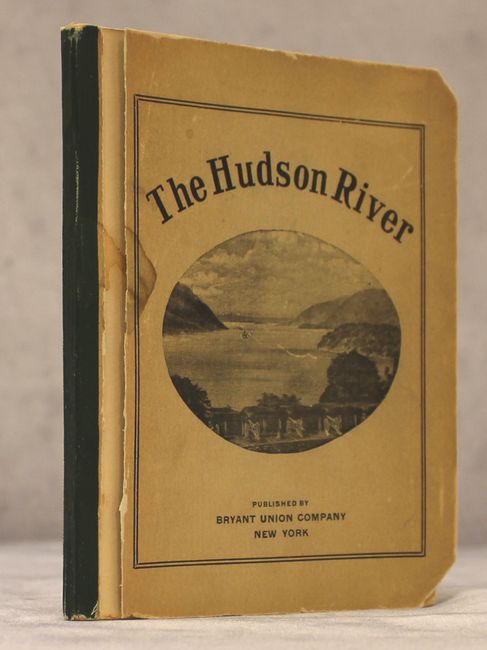
A remarkable map in strip-chart format that is over 100 inches long! Includes amazing detail that is drawn on a scale of 1.5 miles per inch. Complied from U.S. Coast Survey data, this extraordinary map includes the names of prominent residences along the Hudson, historical landmarks and Indian names. The verso of the map is filled with travel information and advertisements. Complete with 30 pp. of text and illustrated with photographs. Folds into paper wrappers entitled "The Hudson River." Published by Bryant Union Company in 1903.
References:
Condition: A
The map is a clean, bright example still attached to back cover. Text and illustrations are excellent. Front paper cover is detached and both covers have a few small chips.