Subject: New York
Period: 1858-65 (dated)
Publication:
Color:
This lot shows the evolving canal network in the state, along with detail of railroads, lakes and rivers.
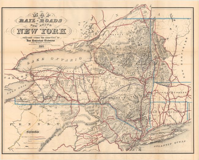
A. Map of the Rail-Roads of the State of New York Prepared Under Direction of Van Reusselaer Richmond State Engineer and Surveyor, by George R. Perkins, dated 1858, hand color (29.1 x 22.5"). Detailed map shows existing, in progress, and proposed railroads along with canals in New York and adjoining states. Delineated by county, the map shows topography, the river system, and numerous place names. Condition: Issued folding with light offsetting and a few tiny splits at fold intersections.
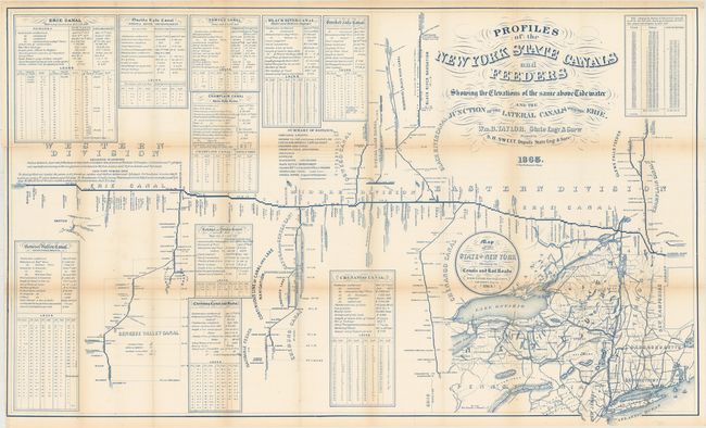
B. Profiles of the New York State Canals and Feeders Showing the Elevations of the Same Above Tidewater and the Junction of the Lateral Canals with the Erie, by S.H. Sweet, dated 1865, printed color (40.3 x 24.5"). A detailed and comprehensive map that includes a large inset map of New York and neighboring states, plus numerous tables of details on other canals. Condition: Issued folding with light toning along the folds and a few tiny splits at fold intersections.
References:
Condition: B+
See description above.