Subject: New York
Period: 1842 (published)
Publication:
Color: Hand Color
Size:
24.4 x 19.2 inches
62 x 48.8 cm
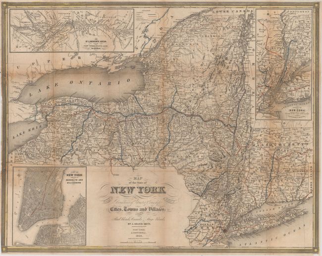
This map of the state and adjoining regions highlights the growing transportation network. It is densely filled with information on canals, railroads, proposed railroads and stage coaches. County and township boundaries are also delineated. The map is surrounded by three insets: "The St. Lawrence River, from the New York State Line to Quebec", "City of New York with Part of Brooklyn and Williamsburg", and "Vicinity of New York." The map was issued in John Disturnell's A Gazetteer of the State of New-York… which contains 475 pages of text describing the state's topography, geology, and mineral resources, as well as a detailed description for every county, town, and village in the state. Includes a frontispiece of the comparative heights of mountains, rivers, lakes, and canals in the state. Octavo, rebound in quarter leather and tips over marbled boards.
References:
Condition: B
The map, which is no longer bound in the book, has light to moderate toning especially along the folds with a few tiny splits at fold intersections. There are a few tears in the left border of the map where it was previously bound, which have been repaired on verso with archival material. Text has moderate toning and foxing. Binding is excellent.