Subject: Nebraska
Period: 1881 (circa)
Publication:
Color: Printed Color
Size:
21.3 x 16.6 inches
54.1 x 42.2 cm
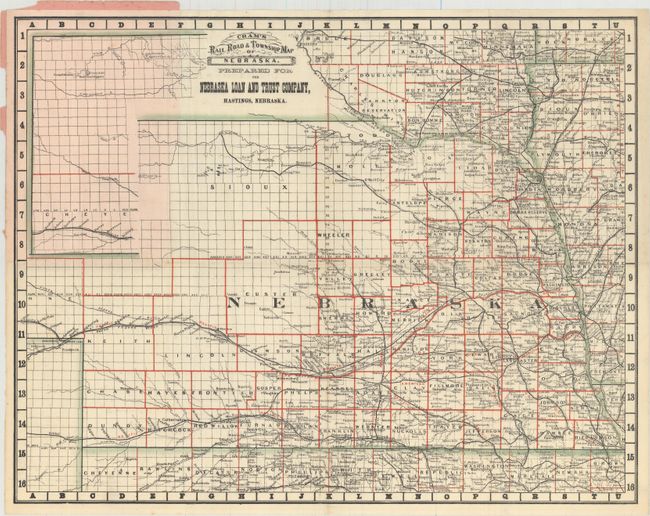
George Franklin Cram was a civil war veteran who marched with Sherman prior to his career as a map publisher. In 1867, George F. Cram and his uncle, Rufus Blanchard, founded the company Blanchard & Cram in Evanston, IL. The company manufactured and sold maps and atlases. Cram became the sole owner two years later and renamed it the George F. Cram Company. They sold a wide variety of atlases including the popular Unrivaled Atlas of the World which was printed continuously from the 1880s to 1952. In 1921, George Cram sold his business to one of his largest customers, E.A. Peterson of the National Map Company. The company is to this day producing quality maps and globes.
This promotional piece was created for the Nebraska Loan and Trust Company based out of Hastings. Cram included as much information as possible on his maps, but he had to leave much of the northwestern portion of Nebraska above Custer County empty as surveys were still underway and there were virtually no settlements. It is filled with high detail in the rest of the state with hundreds of place names, all counties and railroads delineated and named. Embellished with a Victorian-style title. Folds into pink paper wrappers.
References:
Condition: A
A clean, bright example. Still attached to back wrapper with front wrapper missing.