Subject: Minnesota
Period: 1849 (dated)
Publication: Sen Ex. Doc. 42, 3lst Congress, 1st Session
Color: Black & White
Size:
28 x 24.7 inches
71.1 x 62.7 cm
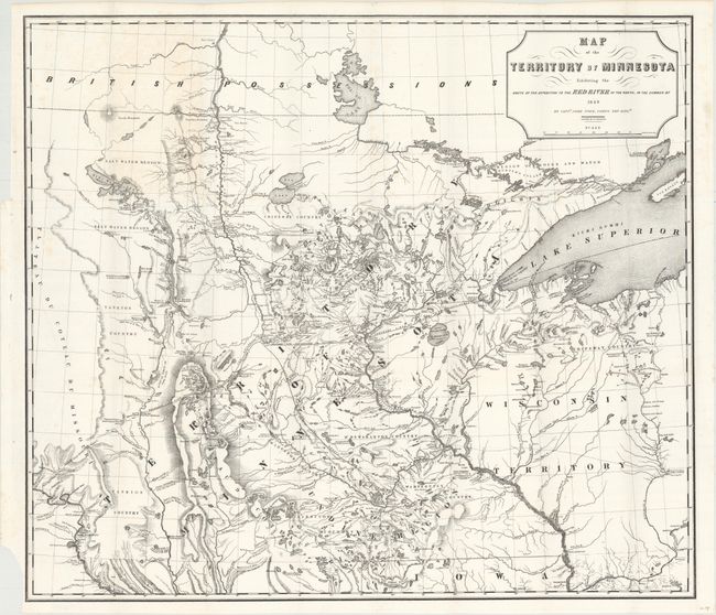
A foundation map for Minnesota from Pope's Report of an Exploration of the Territory of Minnesota. It is based on Nicollet's earlier "Map of the Hydrographical Basin of the Upper Mississippi River." Pope has increased the coverage to include the Lake of the Woods and Canada (British Possessions), and added much new information on rivers and lakes. This is considered the first published map to show the newly formed territory by itself. It details Pope's route from Fort Snelling to the Red River and back. Proposed lines of railroad grants are noted and there is terrific detail of the hydrography and topography. Drawn by P.S. Morawski. A historically important map.
References: Phillips (M) p.432.
Condition: A
An attractive example on a clean and bright sheet with just a bit of toning on the verso showing through at top left where the map folded into the report.