Subject: Hawaii
Period: 1941 (dated)
Publication:
Color: Printed Color
Size:
36.2 x 8.9 inches
91.9 x 22.6 cm
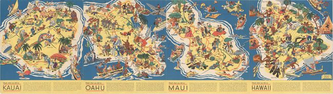
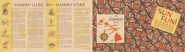
Ruth Taylor White's charming pictorial maps are among the most popular collectible maps of the early 20th century. These whimsical maps, often known as cartographs, combine graphic style, color, and comical observation. This uncommon pamphlet was published by the Honolulu Star-Bulletin. It features four maps, showing the islands of Kauai, Oahu, Maui, and Hawaii. Each is dense with illustrations and features a text key along the bottom that explains the various activities shown. The map of Kauai depicts a young man seated on a water buffalo playing tin can music, the mythical dwarf-like Menehune, and an elderly couple marveling at the botanical gardens. On Oahu there is a May Day or Lei Day celebration, surfing off of Diamond Head, and troops marching with pineapples on their bayonets at Schofield Barracks. The Iao Needle, polo, golf, burning sugar cane fields, and men prospecting lava rocks appear on Maui. As for the island Hawaii, it is distinguished by the presence of the volcanoes Mauna Kea and Mauna Loa, its lava flows, and the spot where Captain Cook landed in 1779. There is a small, less detailed map of the entire archipelago on the verso, as well as informative text on the culture of the island by George Armitage titled "Hawaii Lure & Hawaii Lore."
References:
Condition: A
Overall clear and bright. There are a few tiny fold separations and a minor crease in the bottom left corner.