Subject: Dakota Territory
Period: 1884 (published)
Publication: Sen. Ex. Doc. 70, 48th Congress, 1st Session
Color: Printed Color
Size:
16.1 x 18.1 inches
40.9 x 46 cm
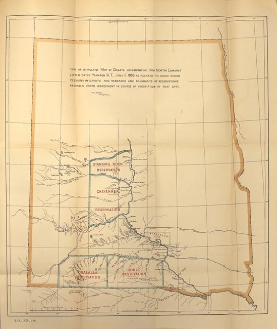
This map shows the proposed boundaries of several reservations in Dakota Territory including the Standing Rock, Cheyenne, Ogalalla, and Brule reservations. Warring conditions in the territory over the previous decades had limited white settlement, and the Office of Indian Affairs made a concerted effort to break up Indian lands into smaller pieces and to buy reservation land to promote growth and stability in the territory. Included with the map is 71 pages of text from the "Report of Commissioner of Indian Affairs Submitting Copies of Sioux Agreements to Cession of Land to the United States." Octavo, hardbound in quarter blue cloth over decorative boards.
References:
Condition: B+
Map is very good with light toning and a 2.5" binding tear at left closed on verso with archival tape. Text is clean and tight, binding near fine.