Catalog Archive
Auction 152, Lot 185

"[Lot of 2] Gray's New Map of Alabama [and] Part of the State of Alabama Showing the Position of the Cherokee Land Within That State Acquired Under the Treaty of 29th December, 1835...",
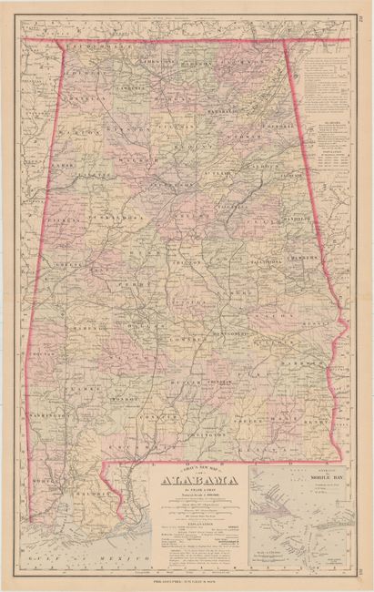
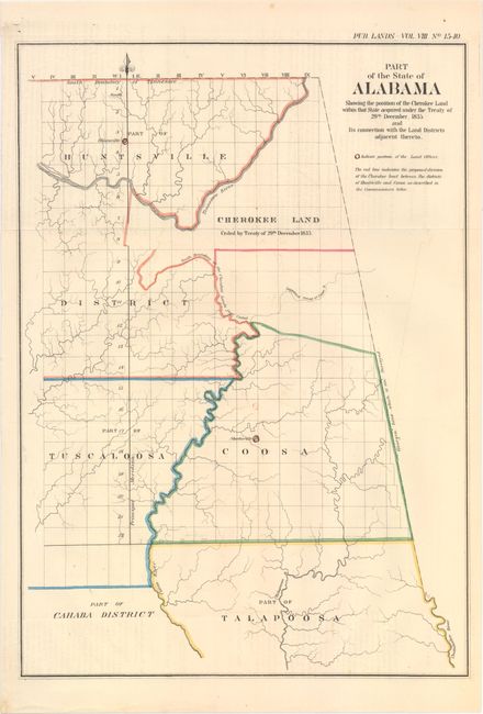
Subject: Alabama

Period: 1861-82 (circa)

Publication:

Color: Hand Color

Size:
See Description
Download High Resolution Image
(or just click on image to launch the Zoom viewer)

A. Gray's New Map of Alabama, by Frank A. Gray, circa 1882 (15.9 x 26.0"). A handsome, double-page map full of information. Details numerous named railroads, cities and towns, counties and county seats, the watershed and lakes. Includes the large inset: "Entrance to Mobile Bay."

B. Part of the State of Alabama Showing the Position of the Cherokee Land Within That State Acquired Under the Treaty of 29th December, 1835..., from American State Papers, circa 1861 (10.4 x 14.8"). This map shows the lands ceded by the Cherokee Indians as part of the Treaty of New Echota, agreeing to surrender their lands to move west of the Mississippi River.

References:

Condition: A

Just a hint of offsetting on the <i>American State Papers</i> map.

Estimate: $120 - $150

Sold for: $70

Closed on 2/18/2015

Archived