Catalog Archive
Auction 152, Lot 181

"New and Correct Map of the Chicago Rock Island and Pacific Ry. Popularly Known as the Great Rock Island Route", Rand McNally & Co.

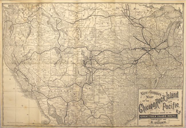
Subject: Western United States

Period: 1881 (dated)

Publication:

Color: Black & White

Size:
18.2 x 12.3 inches
46.2 x 31.2 cm
Download High Resolution Image
(or just click on image to launch the Zoom viewer)

This detailed railroad map covers the western two-thirds of the country, from Chicago west to California and Washington. It depicts numerous main rail lines as well as spur lines and countless small rail stops. Includes very good detail of towns and cities, watershed and topography. Folds into gray paper wrappers with 36 pages of rate information and advertisments.

References:

Condition: B+

The map is overall clean and crisp with a few tiny spots and small damp stains along the border at top left and bottom left. Covers are lightly damp stained with a publisher's stamp on the front cover.

Estimate: $200 - $250

Sold for: $150

Closed on 2/18/2015

Archived