Subject: Western United States
Period: 1853 (dated)
Publication: Smith's Quarto Geography
Color: Hand Color
Size:
9 x 10.4 inches
22.9 x 26.4 cm
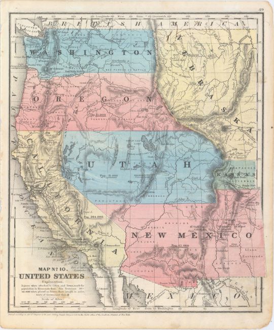
A nice map of the West that displays early territorial boundaries. New Mexico Territory is shown with the post-Gadsden Purchase border plus the northern extension into today's Colorado. Oregon and Washington extend to the Continental Divide and a huge Nebraska occupies the area to the east with a small area east of Utah labeled Kansas. The large Utah Territory extends to the Continental Divide. Each state/territory is labeled with their population: Utah 11,000; New Mexico 62,000; Oregon 13,000; California 264,000. Numerous Indian tribes and military fort are located.
References:
Condition: B+
Minor soiling in the lower portion of the image with a couple of soft creases and a few small ink marks in the upper right corner.