Subject: World
Period: 1700 (circa)
Publication: Dampier's Voyages and Descriptions
Color: Black & White
Size:
11.7 x 5.9 inches
29.7 x 15 cm
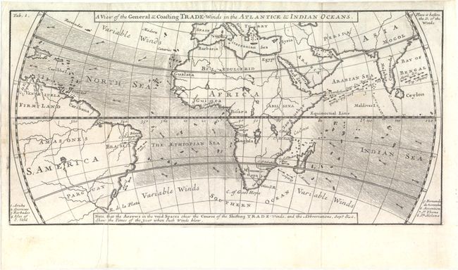
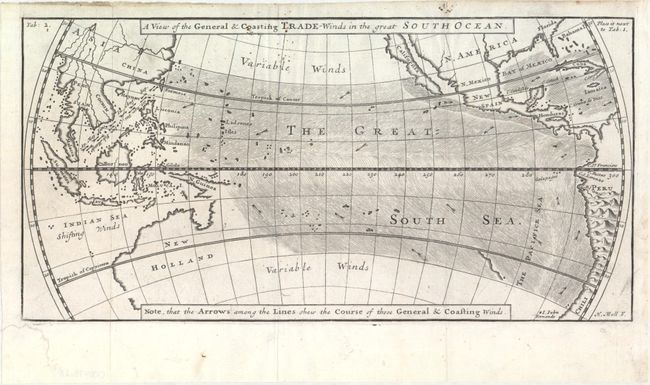
Important pair of maps from the third edition of William Dampier's "Voyages and Descriptions." Dampier, based upon his own knowledge and information from other mariners, produced the first map of trade winds in the Pacific Ocean. He also showed that the boundary between the southeast and northeast trade winds was not the equator, but 5 degrees to the north. The map of the Pacific depicts California as an island and an incomplete coastline of Australia, which appears to be connected to New Guinea.
William Dampier (1652-1715) was a soldier, buccaneer, pirate, British navy captain and hydrographer. He was also among the most influential of travel writers. Dampier completed his first circumnavigation between 1679 and 1691, during which he was among the first group of Englishmen to land in New Holland (Australia).
References: Shirley (BL Atlases) G.DAM-1a #8 & #9.
Condition: A
Clean and bright examples on watermarked paper with one small hole prfessionally infilled in the northern map and a archivally repaired chip in the bottom corner of the blank margin in the southern map.