Subject: Central United States
Period: 1837-1860 (circa)
Publication: American State Papers
Color: Black & White
Size:
15.3 x 21 inches
38.9 x 53.3 cm
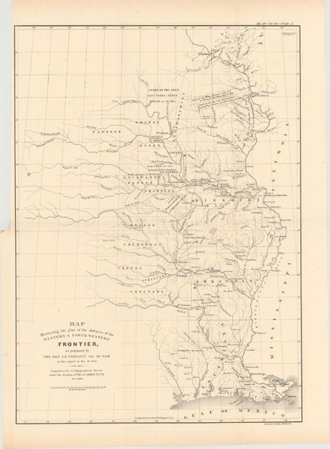
This map was issued as part of the continuing debate over the nature of the frontier defenses between the Mississippi River and the Rocky Mountains in the Secretary of War, J.R. Poinsett's report of 1837. It illustrates the proximity of the hostile Indian threat that existed in the 1830s and shows the location of Army posts that were expected to respond to any hostile action. The military troops at these individual posts were inadequate to counter significant Indian opposition making it necessary for speedy reinforcement. The map includes the states of Missouri, Arkansas and Louisiana and the Indian nations bordering them to the west. Locates many military forts and outposts from Ft. Jessup to Ft. Snelling with notations throughout concerning the regions ceded by several Indian nations with the dates of the treaties. Originally published in conjunction with a similar proposal by Charles Gratiot (see preceding lot). This is the reissued map published in American State papers circa 1860.
References: cf. Wheat (TMW) #426.
Condition: A
A clean and bright example issued folding with a binding trim at upper left and an associated 0.75" binding tear closed on verso with archival tape.