Catalog Archive
Auction 152, Lot 172

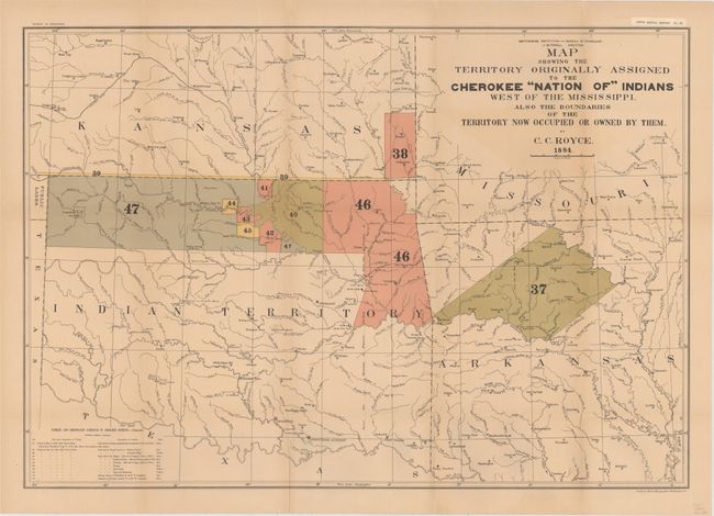
"Map Showing the Territory Originally Assigned to the Cherokee "Nation of" Indians West of the Mississippi. Also the Boundaries of the Territory Now Occupied or Owned by Them", Royce, C. C.

Subject: South Central United States, Oklahoma

Period: 1884 (dated)

Publication: Bureau of Ethnology Fifth Annual Report Pl. IX

Color: Printed Color

Size:
29.9 x 20.6 inches
75.9 x 52.3 cm
Download High Resolution Image
(or just click on image to launch the Zoom viewer)

This large map depicts, by coloring and numeric key, those lands owned and ceded by the Cherokee Indians. The map shows the former territorial limits of the Cherokee Nation between the Ohio and Tennessee Rivers and the Appalachian Mountains. It depicts the various cessions made by them to the United States up to their removal to west of the Mississippi. It lists cessions numbered 37 through 47, and the Treaties of May 6, 1828 and July 19, 1866. The map also includes a small section of Public Lands, Kansas, and Arkansas, showing many villages, forts, and Indian Agencies.

References:

Condition: B+

Issued folding with minor offsetting near the title at top and several fold separations, as is typical with this thick paper, all closed on verso with archival tape. Original paper label at upper right above neatline, "Fifth Annual Report Pl. IX."

Estimate: $200 - $230

Sold for: $150

Closed on 2/18/2015

Archived