Catalog Archive
Auction 152, Lot 170

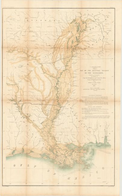
"Map of the Alluvial Region of the Mississippi…", U.S. War Department

Subject: Southern United States

Period: 1861 (dated)

Publication: U.S. Miss. Delta Survey

Color: Hand Color

Size:
18.1 x 28.4 inches
46 x 72.1 cm
Download High Resolution Image
(or just click on image to launch the Zoom viewer)

Detailed map covers the region from the confluence of the Ohio and Mississippi Rivers to the Gulf of Mexico. It shows the floodplain of the Mississippi and its tributaries including the Arkansas and Red Rivers. From Humphreys & Abbot's Report on Hydraulics and Physics of the Mississippi River and its Tributaries.

References:

Condition: B+

Issued folding with light toning and a few small damp stains along the folds. There are a few tiny splits at fold intersections closed on verso with archival tape.

Estimate: $160 - $200

Sold for: $120

Closed on 2/18/2015

Archived