Subject: Southeast United States
Period: 1788 (circa)
Publication: The History of Rise, Progress and Establishment of the…United States
Color: Black & White
Size:
14 x 13.6 inches
35.6 x 34.5 cm
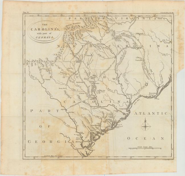
An uncommon map of the Carolinas showing the routes of British and American forces during the Revolutionary War. It illustrates the routes of pursuit and retreat of the troops of Cornwallis, Greene, Lee and Stuart. The map shows forts, towns, ferry crossings, and battle sites. The topography is simple, and the Appalachians are referred to as the Alleghany Mountains, a term that was frequently used at this time for the whole range from Pennsylvania south to the Carolinas. Published in William Gordon's The History of Rise, Progress and Establishment of the Independence of the United States.
References: Howes #G256.
Condition: B
Issued folding with light offsetting, moderate foxing, and an edge tear at right that just extends past the neatline. Binding trim at lower right.