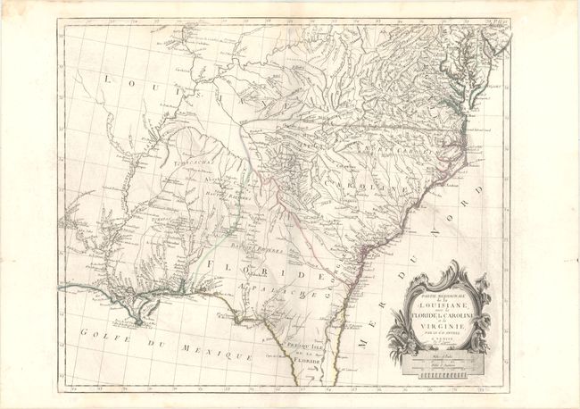
Subject: Southeast United States
Period: 1784 (circa)
Publication: Atlas Universel...
Color: Hand Color
Size:
23.1 x 19 inches
58.7 x 48.3 cm
This is an interesting Italian version of D'Anville's map of the Southeast. It is most notable for the incorrect boundaries showing a huge Louisiana extending eastward to include present-day Kentucky, Mississippi, and Alabama. The boundary between the Carolinas and Florida is shown at the Alatamaha ou George R, and Georgia is not delineated, but is named (Georgie). In the left border of the map is the note of Presidio Espagnol de la Prov. de Tecas in modern-day Texas. Good detail of towns and cities, Indian villages and tribes, rivers, portages, forts, harbors, and early place names. Second state, published by Remondini.
References: Phillips (A) #647-48; Sellers and Van Ee #1408.
Condition: B+
Original outline color on a watermarked sheet with some printer's ink residue and minor damp stains at top and in bottom left corner.