Subject: Mid-Atlantic United States
Period: 1769-1862 (dated)
Publication:
Color: Black & White
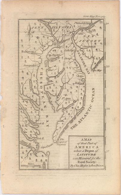
A. A Map of That Part of America Where a Degree of Latitude Was Measured for the Royal Society: by Cha. Mason, & Jere. Dixon, by Anonymous, from Gentleman's Magazine, published 1769 (3.8 x 6.5"). This interesting little map covers the Delaware peninsula north to Philadelphia with only a few cities including Annapolis, Baltimore, and Greenwich. It locates many early settlements and shows the roads that connect them. The focus of the map is the initial measurements made by Charles Mason & Jeremiah Dixon for what has become known as the Mason-Dixon Line. These two British astronomers were employed to make this survey in order to resolve a long-standing dispute between the Calvert family, proprietors of Maryland, and the Penn family of Pennsylvania. This map, one of the first to show the results of the Mason- Dixon survey, shows this initial degree of latitude set into the context of the lands around the Chesapeake and Delaware Bays. The map is a slight variant of a map that appeared the previous year in The Philosophical Transactions of the Royal Society of London, reflecting the general public interest in this border dispute in the American colonies. Ref: Jolly #GENT-199. Condition: A nice impression with a little offsetting from an opposing page of text.
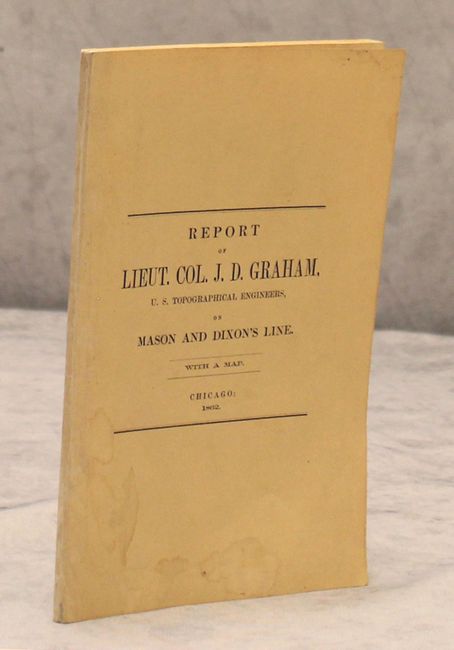
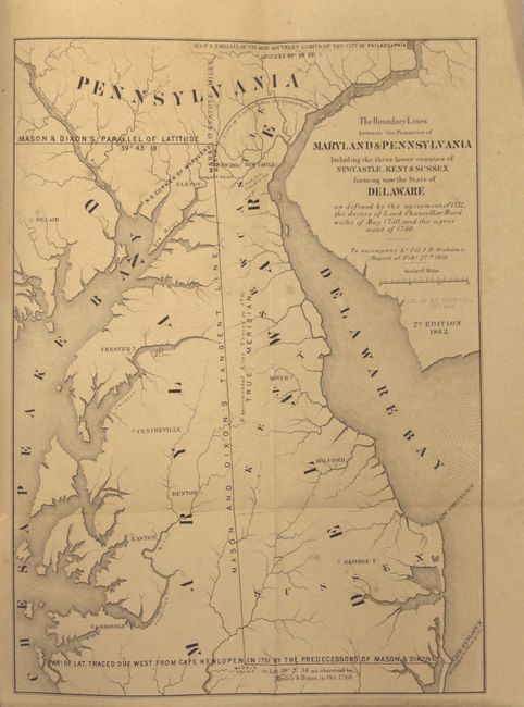
B. Messages from the Governors of Maryland and Pennsylvania ... A Portion of Mason and Dixon's Line. With a Map. Second Edition, by James D. Graham, published 1862 (6.0 x 9.1"). This pamphlet contains the results of a joint survey commissioned in 1845 by Maryland, Pennsylvania, and Delaware to determine the exact course of the Mason-Dixon Line through portions of those three states under the direction of J. D. Graham, a highly regarded topographical engineer. This is the second edition and has a fold-out map The Boundary Lines between the Provinces of Maryland & Pennsylvania Including...Delaware (7.8 x 10.6"). Condition: The map is lightly toned with a few minor spots of foxing. The text is clean and bright, and the paper wrappers have just a few faint damp stains.
References:
Condition: B+
See description above.