Subject: Maine, New Hampshire, & Vermont
Period: 1788 (circa)
Publication: The History of Rise, Progress and Establishment of the…United States
Color: Black & White
Size:
13.5 x 14.5 inches
34.3 x 36.8 cm
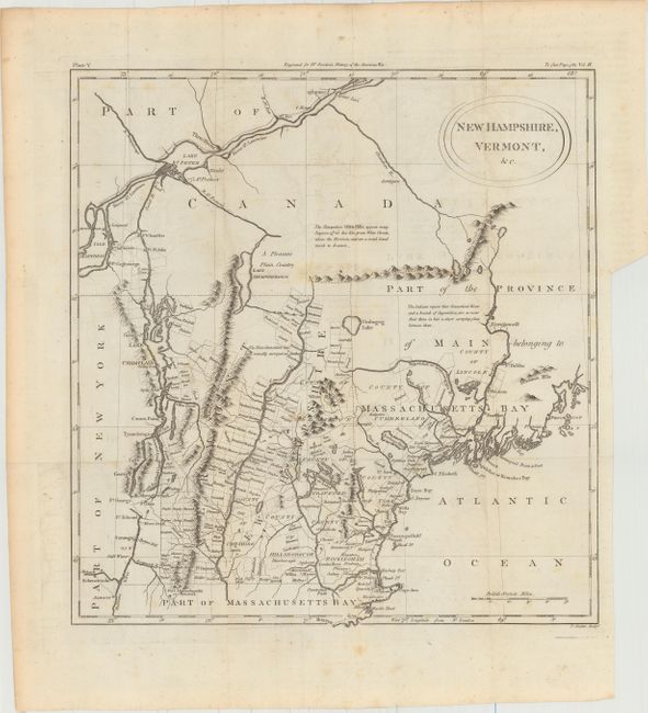
This uncommon and interesting map details the coast from Boston to Penobscot Bay, and inland to Lake Champlain and the St. Lawrence, north to Quebec. The map shows the surveyed townships in New Hampshire and Vermont, as well as the Province of Main (Maine), then a province of Massachusetts. The map notes Pemaquid Fort, Casco Bay, Cape Elizabeth, Saco, and Wells along the coast of Maine. Lake Sebago is noted as Scebago Pond, and Lake Umbagog is placed correctly in its position on the border between New Hampshire and Maine. The White Mountains are described with a poetic note: The Hampshire White Hills, appear many leagues off at Sea like Great White Clouds, above the Horizon, and are a noted Landmark to Seamen. Published in William Gordon's The History of Rise, Progress and Establishment of the Independence of the United States.
References: McCorkle #788.2; Howes #G256.
Condition: B+
Issued folding with faint ofsetting, a few minor spots of foxing, and a binding trim at right.