Subject: Colonial New England
Period: 1755 (dated)
Publication: General Magazine of Arts & Scinece
Color: Hand Color
Size:
7 x 8 inches
17.8 x 20.3 cm
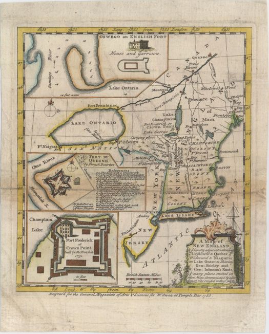
This uncommon map of New England covers the area from Quebec to Delaware Bay and west to Lake Ontario. It depicts towns, forts, rivers, portages, and the routes of the British marches during the French and Indian War. Three insets provide details of the forts at Oswego, Duquesne and Frederick (Crown Point). The map illustrates the British campaigns against the French forts at Niagara and Crown Point. The movement against Niagara was led by Governor Shirley, which was turned back at Fort Oswego. General William Johnson's campaign was more successful. He led nearly four thousand troops, mostly from New England, against Ft. Frederick. He defeated the French commander Dieshau at a battle near Lake George and secured for the British their only victory for the year. Published in the November 1755 issue.
References: Jolly #GEN-MAS-70; McCorkle #755-27; Sellers & Van Ee #64.
Condition: B
Issued folding, now pressed with a long separation along one fold that has been closed on verso. There is light toning along the fold, a few minor extraneous creases, and light soiling.