Subject: Colonial Eastern United States, Great Lakes
Period: 1762 (circa)
Publication: American Gazetteer
Color: Hand Color
Size:
13.8 x 11 inches
35.1 x 27.9 cm
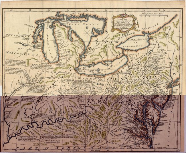
This uncommon map covers the region from Virginia and Kentucky north to the Great Lakes and west to the Mississippi River. Roads, rivers, mountains, lakes, towns, forts, Indian tribes, and other features are seen. There are numerous notations, many related to Indians, including "The Six Nations have extended their territories to the River Illinois ever since the year 1672" and "the Western Extent of the Territories of the Six Nations and Bounds of their Deed of Sale to the Crown of Great Britain…" Engraved by John Gibson and published in Andrew Millar’s American Gazetteer. An attractive post-French & Indian War map.
References: Phillips (America) p. 674.
Condition: B+
Issued folding with attractive color on watermarked paper. Trimmed to the neatline at lower left and bottom.