Subject: United States
Period: 1883-1910 (circa)
Publication:
Color:
A historical set of maps showing the evolution of Indian reservations over a 27-year period including:
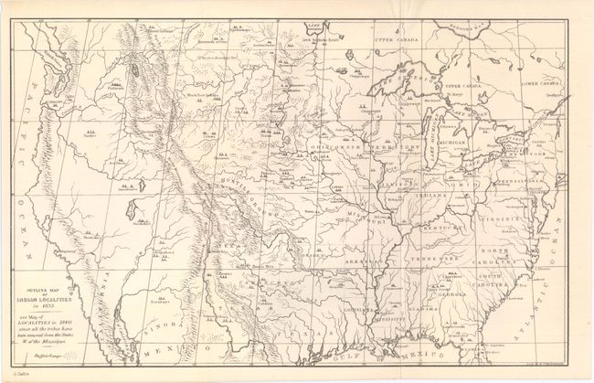
A. Outline Map of Indian Localities in 1833, by George Catlin, from Catlin's Indian Gallery, circa 1887, black & white (13.1 x 8.2"). The map names scores of Indian villages, all located by tipi symbols. The map extends well into Canada, locating numerous Canadian tribes. There is good detail of watershed and the known mountain ranges. The west is mostly blank and contains erroneous information in the Great Basin region derived from Fremont's map, including an east-west flowing river. Texas is shown with its northern border extending well into the Rocky Mountains, but it is indistinct at its upper reaches. Of special interest is the depiction of the Buffalo Range that stretches throughout the entire plains region. Condition: (A+)
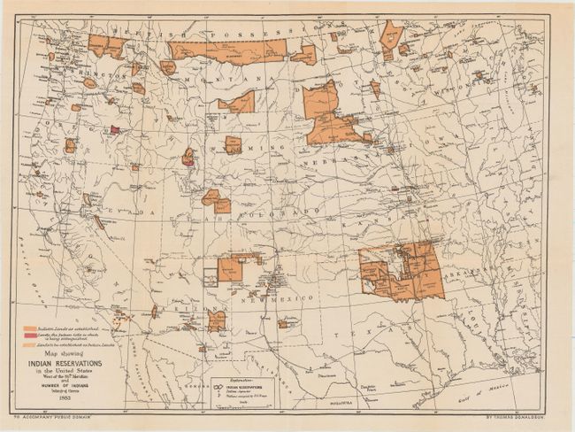
B. Map Showing Indian Reservations in the United States West of the 84th Meridian and Number of Indians Belonging Thereto 1883, by Thomas Donaldson, dated 1883, printed color (17.6 x 13.3"). A finely engraved example that shows existing, proposed and "extinguished" Indian lands in unique colors. The map also shows Indian agencies, Army outposts, towns, railroads and Yellowstone National Park. Condition: A hint of toning. (A)
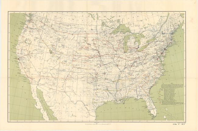
C. [Untitled - United States Showing Indian Reservations and Schools], by U.S. Geological Survey, circa 1893, printed color (28.2 x 17.4"). This fascinating map shows the 13 routes of government examiners to Indian schools, which are identified by small red triangles. Also shows post offices and customs districts. Condition: A clean and bright example with one tiny fold separation. (A)
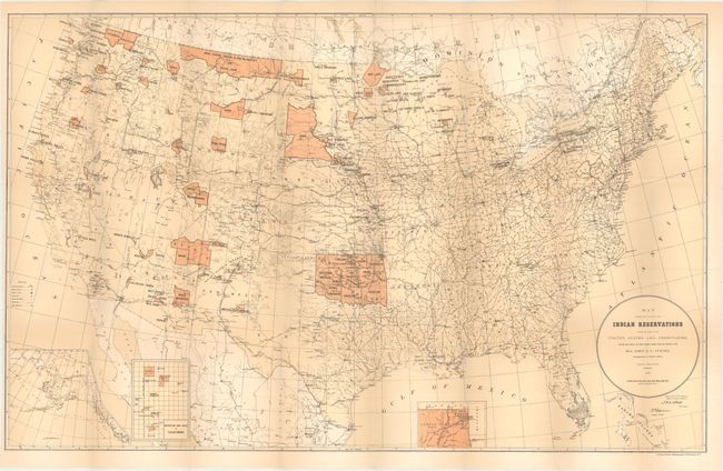
D. Map Showing the Location of the Indian Reservations Within the Limits of the United States and Territories, by Paul Brodie, dated 1885, printed color (33.5 x 21.1"). Large and detailed, it locates towns, railroads, military stations and Indian agencies. Condition: Issued folding with light toning and a 3" binding tear at left closed on verso with archival tape. (B+)
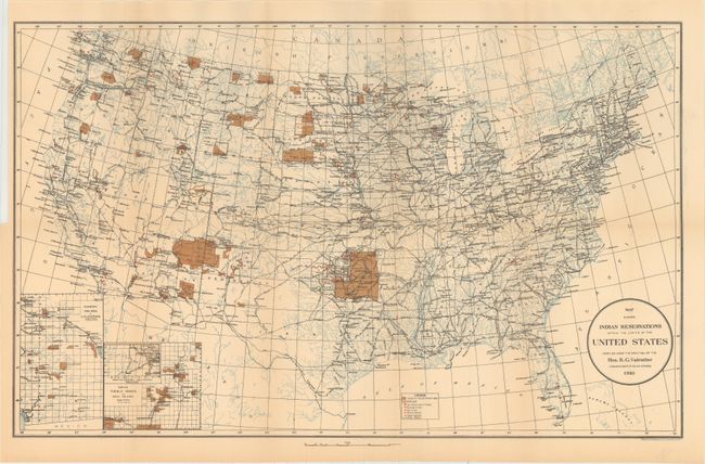
E. Map Showing Indian Reservations Within the Limits of the United States Compiled Under the Direction of the Hon. R. G. Valentine Commissioner of Indian Affairs, by U.S. Geological Survey, dated 1910, printed color (24.3 x 15.0"). Updated version of the above demonstrating the shrinking reservations. Condition: Minor toning. (A)
References:
Condition:
All issued folding. See description above for additional details.