Subject: Colonial Central United States & Canada
Period: 1753 (circa)
Publication: Atlas Geographicus
Color: Hand Color
Size:
14.3 x 13.6 inches
36.3 x 34.5 cm
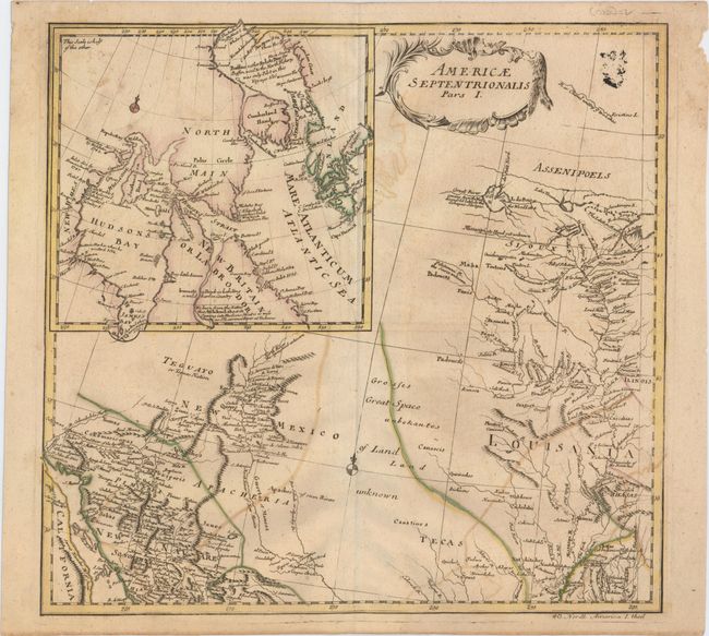
This scarce map is one sheet of von Euler's four-part map of North America. This sheet covers the region from the Mississippi River valley through the American Southwest. It stands alone with a decorative cartouche and border. It presents a detailed view of French Louisania and the Spanish possessions in New Mexico with a Great Space of Land Unknown and Tecas in between. A notation on a river flowing into Lake of the Woods (The Wood Lake) remarks, "Great River coming from the West discovered lately by the Oshages Savages." A large inset map illustrates Hudson and Baffin Bays with numerous English notations concerning discoveries in the region. A partial imprint of Euler's "cum privilegio" stamp is at top right.
References:
Condition: B+
Original outline color on watermarked paper with light color offsetting and minor soiling mostly in the top corners of the sheet.