Subject: Eastern United States & Canada
Period: 1838 (dated)
Publication:
Color: Hand Color
Size:
33.7 x 22.3 inches
85.6 x 56.6 cm
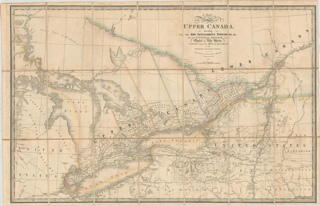
A large and boldly engraved copper plate map. It extends westward to include Lake George, part of Lake Superior and Detroit, eastward to Quebec, and as far south to include New Salem, Sandusky and Fort Miamis. Filled with towns and settlements and individual named townships, roads and trails including an unfinished one heading west from Detroit. Many interesting notations, e.g., "This Creek in the Western Boundary of the Six Indian Nations has many Rapids," and "This River is a good Harbour for Vessels of 60 Tons." This is the seventh and final edition with the first appearance of railroads. Dated 1838 but published in circa 1850. Dissected and backed on original linen that self-folds into plain brown wrappers. An infrequently seen issue.
References: Tooley (Amer) p.102 #82g.
Condition: B
There are some light stains and minor offsetting in the image. A few of the panels have become partially separated from the linen, but the image is unaffected.