Subject: New Brunswick, Canada
Period: 1867 (dated)
Publication:
Color: Hand Color
Size:
38.1 x 35.1 inches
96.8 x 89.2 cm
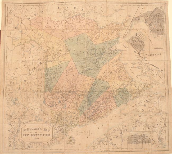
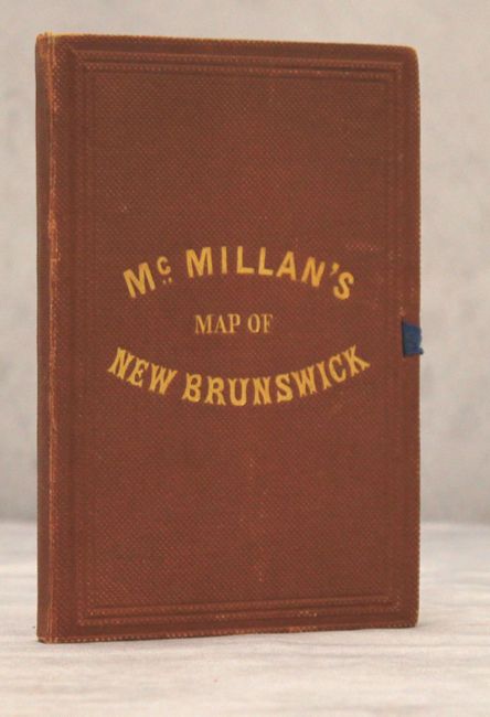
This large folding map of New Brunswick divides the province into 14 counties, prior to the formation of Madawaska County in 1873. There is excellent detail o f roads, railways (including those proposed and under construction), towns, and post offices. The map extends to include portions of Maine, the Gaspe Peninsula, Nova Scotia, and Prince Edward Island. A large inset at top right shows St. John Harbor with bird's-eye plans of the cities of Carleton, Portland, and St. John. A smaller inset at bottom right shows a bird's-eye plan of Fredericton, York County, along the St. John River. Drawn by Chas. C. Gregory and engraved by George Philip & Son. Dissected and mounted on linen. Folds into brown pebbled cloth-covered boards with gilt title on front cover.
References:
Condition: B
Original color with light toning and scattered foxing. The covers are in excellent condition with very minor wear. The original ribbon tie is perished.