Subject: Central Canada
Period: 1859 (published)
Publication:
Color: Hand Color
Size:
10 x 13.4 inches
25.4 x 34 cm
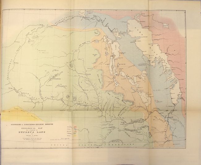
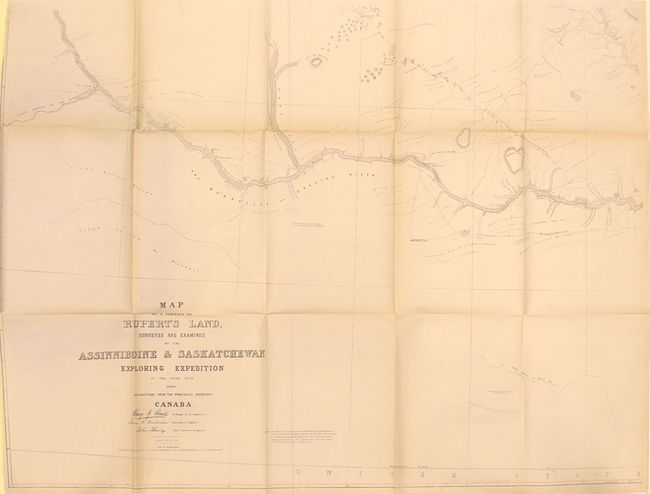
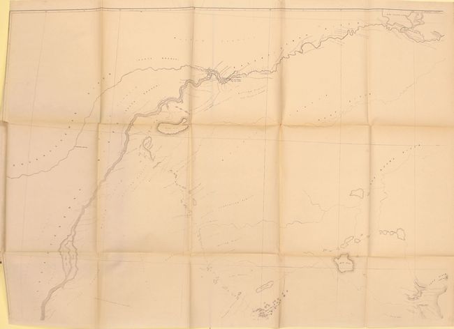
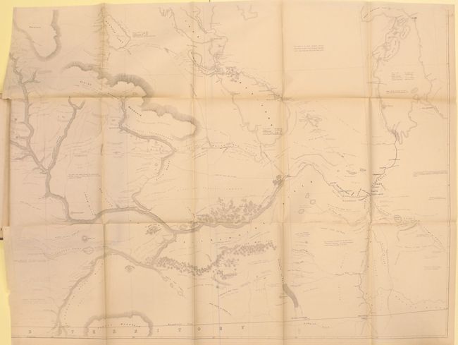
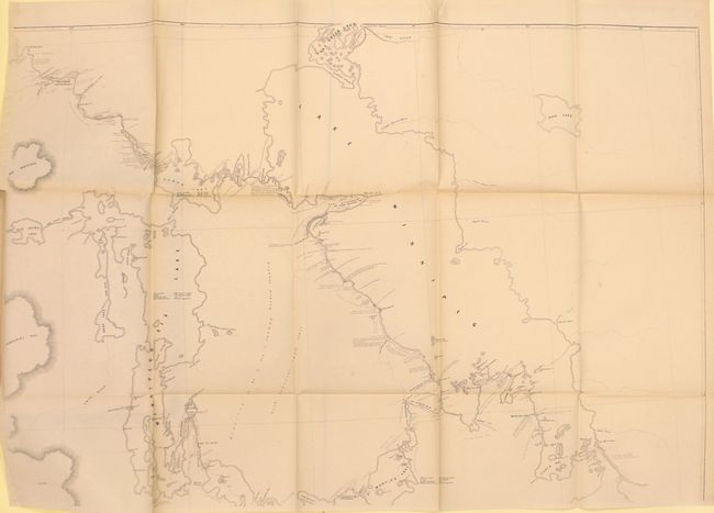
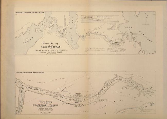
This report describes Henry Youle Hind's journey into the then western frontier of Canada, including today's Manitoba and Saskatchewan. His surveying expedition covered the region from Lake Winnipeg and the Red River west to the Saskatchewan River and bounded to the south by the Qu'Appelle and Assiniboine River. Hind's mission had the dual purpose of understanding the topography and geology of the region for potential settlement, and to establish potential emigrant routes to the west. Included with the 202-page report are 5 map sheets (2 maps), 4 folding plates and 2 single fossil plates. Of particular interest is the massive, unjoined, four-sheet map entitled Map of a Portion of Rupert's Land, Surveyed and Examined by the Assinniboine & Saskatchewan Exploring Expedition (which would measure approximately 80 x 60" if joined). This map has incredible detail of the expedition, the topography, and observations about the land including "Vast Level Prairie adapted for Agriculture," "Rich Clay Loam," and "Beautiful Undulating Prairie." Rebound in quarter brown cloth over marbled boards with gilt title on spine.
References: Wagner-Camp #330:1; Marcou & Marcou #643.
Condition: A
The maps are in very good to near fine condition with the large folding map appearing to have only been opened a few times. Text and plates are excellent with just one cross-section plate toned. New binding is pristine.