Catalog Archive
Auction 151, Lot 752

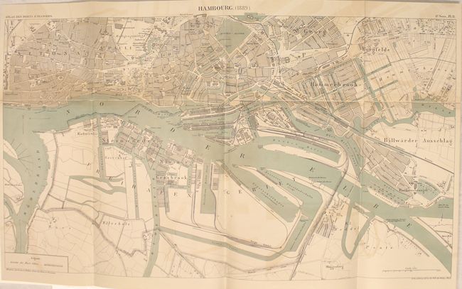
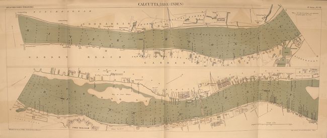
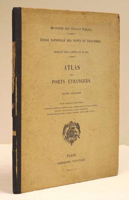
"Ministere des Travaux Publics. Ecole Nationale des Ponts et Chaussees. Service des Cartes et Plans. Atlas des Ports Etrangers. Sixieme Livraison",
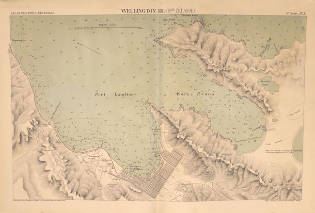
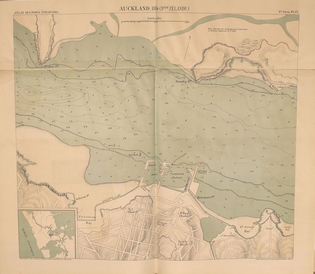
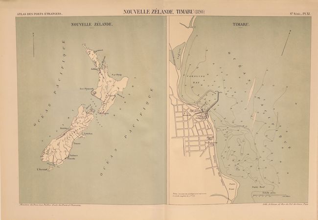
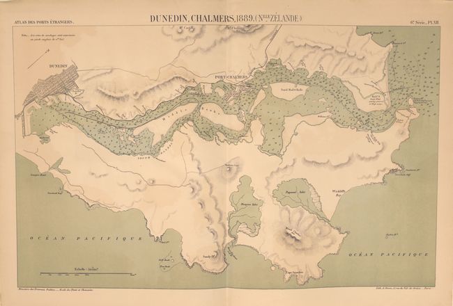
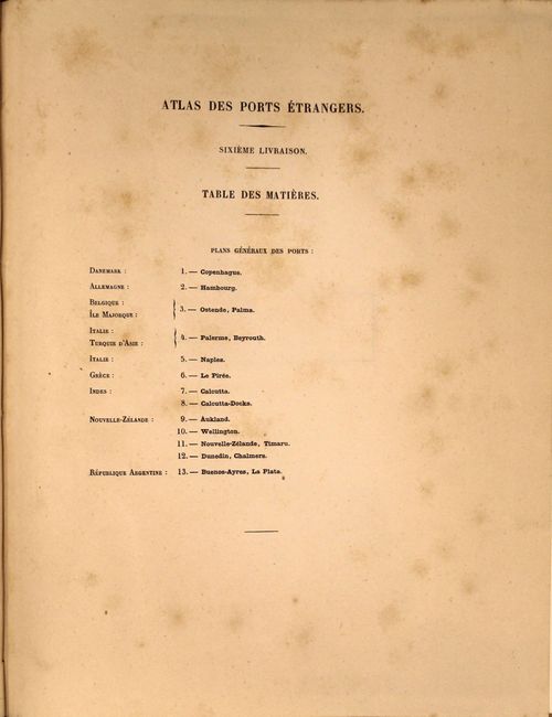
Subject: Atlases

Period: 1890 (published)

Publication:

Color: Printed Color

Size:
10.6 x 13.4 inches
26.9 x 34 cm
Download High Resolution Image
(or just click on image to launch the Zoom viewer)

This interesting and unusual 19th century French atlas contains 13 maps of "foreign" ports including Copenhagen, Hamburg, and Calcutta as well as 4 maps dedicated to New Zealand demonstrating its importance as a trading partner. The sheets are tipped in with blank versos and include 4 fold outs and 5 double-page maps. Each shows very good detail of soundings, shoals, current direction and docks. Published in Paris by the Imprimerie Nationale (National Printing). Hardbound in paperboard covers with title page printed on front cover.

References:

Condition: B+

The maps are good to very good with occasional scattered foxing and color offsetting. Covers are lightly foxed, the edges are bumped, and the spine is cracking.

Estimate: $140 - $170

Sold for: $80

Closed on 11/19/2014

Archived