Subject: Atlases
Period: 1867 (published)
Publication:
Color: Hand Color
Size:
14.8 x 18.6 inches
37.6 x 47.2 cm
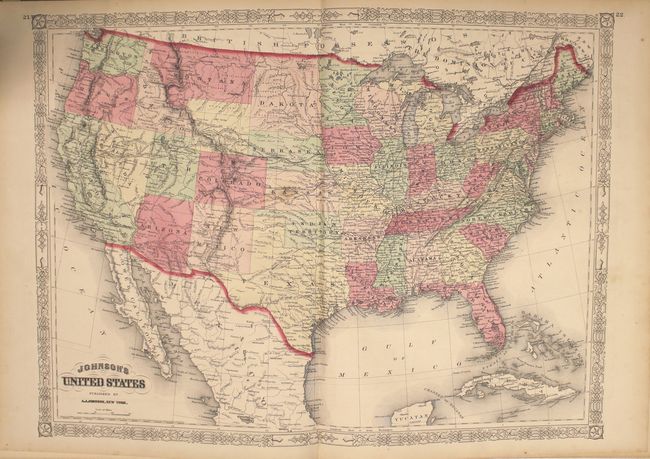
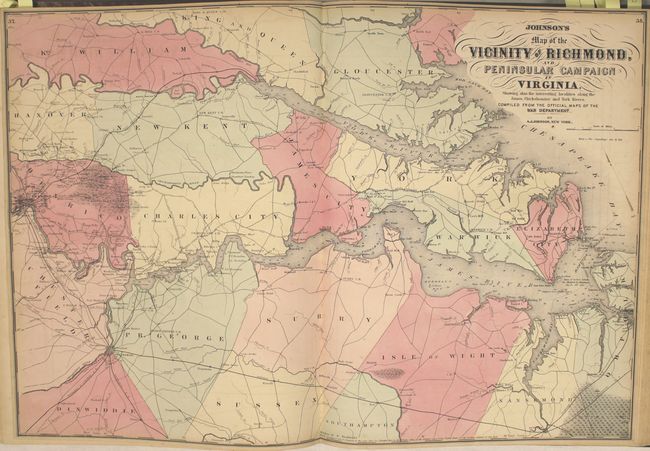
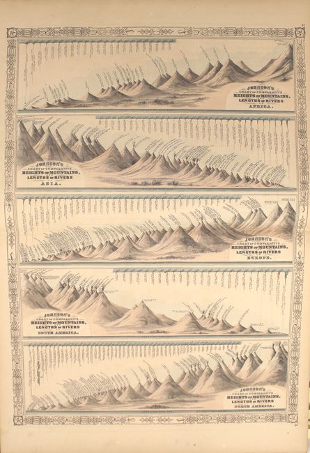
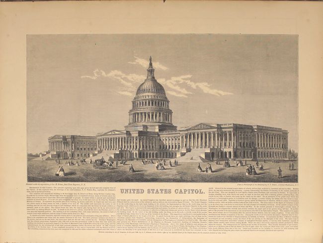
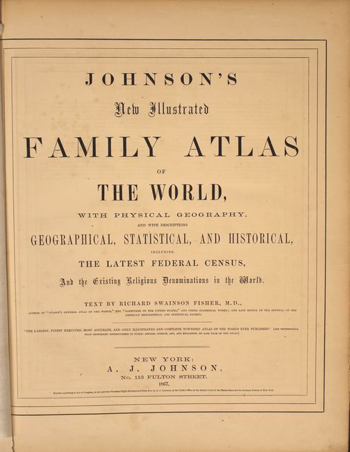
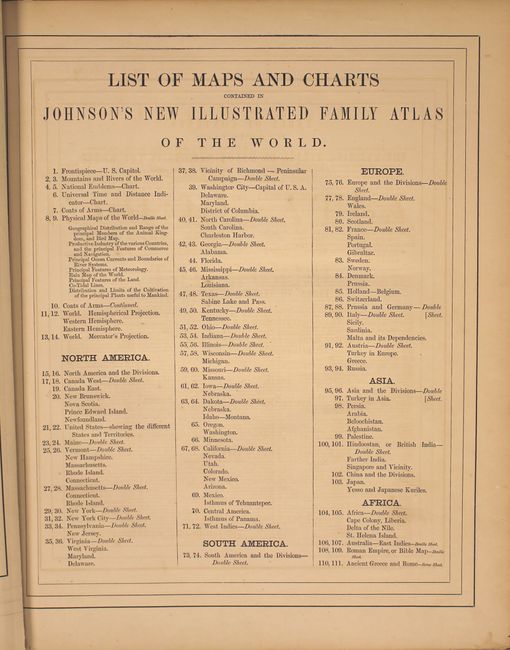
This complete atlas contains 55 beautifully rendered maps, including 47 double-page maps. There are several thematic maps and diagrams interspersed throughout the text that display the geology, weather, tides, agriculture, flags and animal kingdoms of the world. The steel-engraved frontispiece is a lovely view of the US Capitol. This atlas also features the double-page Civil War map Vicinity of Richmond.
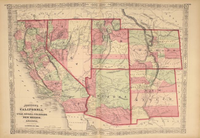
This edition includes the Southwest map depicting the original four counties of Yavapai, Mohave, Yuma, and Pima in the newly organized Arizona Territory, with Prescott as the capital. The Utah/Nevada border is now at 114° and Arizona and Nevada have their final borders. Early historical details include the Pony Express and United States Mail routes, the emigrant roads to California, and the proposed southern railroad route.
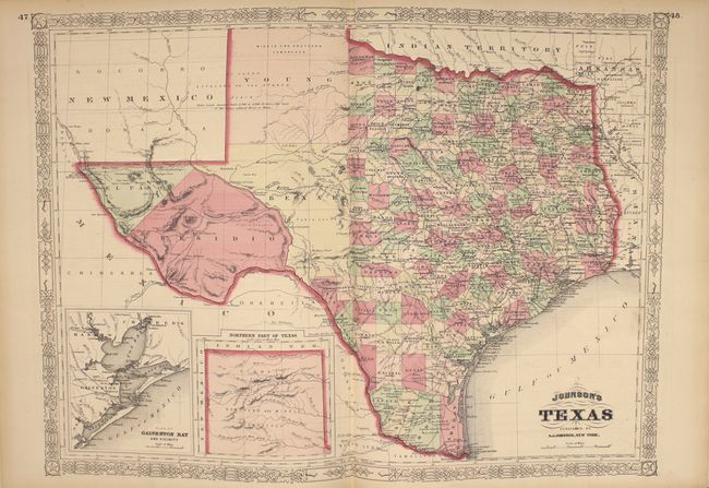
The double-page map of Texas shows county development mostly in eastern Texas and only the four large counties of Young, El Paso, Presidio and Bexar in the west. The panhandle, noted as the Staked Plains … without Wood or Water, includes a large section that is unorganized. There is nice depiction of the wagon roads, many named, with several completed railroads. The inset maps are 'Northern part of Texas' and 'Plan of Galveston Bay.'
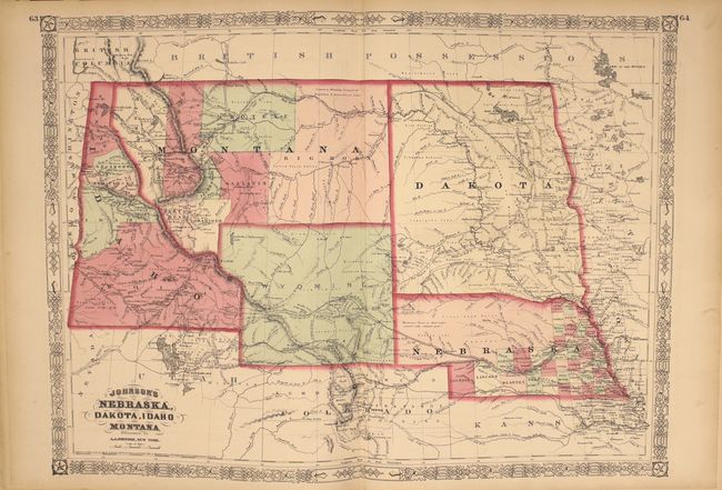
The double-page map of 'Nebraska, Dakota, Idaho and Montana' shows a very early rendering of Wyoming Territory, organized in 1868. Idaho is shown taking up the present-day Wyoming region south of Jackson Hole. With the exception of the southwestern border, Montana is correctly formed which, along with Wyoming, was previously contained in a large Idaho territory. Dakota Territory, from which Wyoming was formed, remains undivided. There is excellent detail throughout with scores of place names, roads, watershed, topography, the Emigrant Road, forts, springs, routes of exploration and proposed railroads. The route of the Pony Express & U.S. Mail Route through Utah, Wyoming and Nebraska is delineated.
Folio. 137 pp., frontispiece, 55 maps, and 5 charts depicting mountains and rivers of the world, flags, universal time, and coats of arms. Hardbound in original quarter leather with tips and green cloth, embossed covers with gilt titles on cover and spine, marbled pastedowns.
References:
Condition: B+
The maps are all in very good to near fine condition with bright original color, light toning around sheet edges, occasional spots of foxing, and minor offsetting on a few maps. Four double-page maps have long centerfold separations that have been closed on verso with archival tape, and the map of New York State has a 4" tear along the centerfold that has also been closed on verso with archival tape. The binding is sound. The front and back free-endpapers have been removed, and the last page in the atlas is partially detached. The covers and spine show moderate wear.