Catalog Archive
Auction 151, Lot 650

"Carte des Isles Philippines Dressee sur la Carte Espagnole du R.P. Murillo de Velarde 2e Feuille...", Bellin, Jacques Nicolas

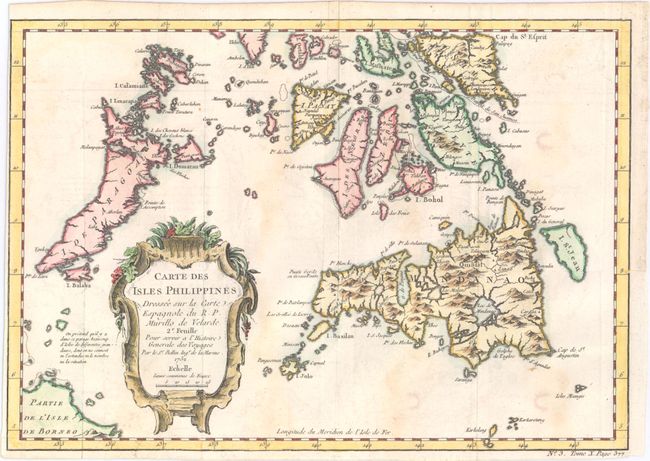
Subject: Philippines

Period: 1752 (dated)

Publication: Prevost's Histoire Generale des Voyages

Color: Hand Color

Size:
11.9 x 8.3 inches
30.2 x 21.1 cm
Download High Resolution Image
(or just click on image to launch the Zoom viewer)

Attractive map depicts the southern islands of the Philippine archipelago, including Mindanao, Palawan, Panay, and part of Borneo. The map has good detail throughout and is adorned by a lovely rococo-style title cartouche. Although Bellin credits Jesuit priest Pedro Murillo Velarde as the source for the cartography of the region, Velarde's original map did not include the mythical island of St. Johann, which is here depicted to the east of Mindanao.

References:

Condition: B+

Issued folding with faint offsetting and a few small spots. Narrow margins at left and bottom.

Estimate: $180 - $210

Sold for: $90

Closed on 11/19/2014

Archived