Subject: Burma & Sumatra
Period: 1750 (circa)
Publication: The English Pilot. Third Book
Color: Hand Color
Size:
23.7 x 19.4 inches
60.2 x 49.3 cm
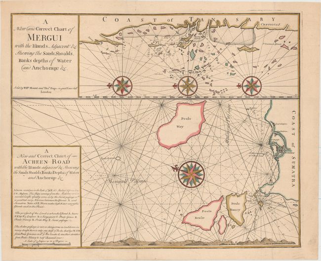
This rare sheet includes two charts filled with navigational details, including soundings, anchorages, rocks, and shoals. The top chart shows the western coast of Burma near the southern tip of the country, centered on Tenasserim. Several large compass roses orient north to the left. The bottom chart shows the coast along the northwestern tip of Sumatra, with the adjacent islands of Pulau We, Pulau Breueh, and Pulau Nasi. The lower map includes a large compass rose orienting north to the top left and a land approach view with a lettered guide explained in the title cartouche.
References:
Condition: A
A fine impression with attractive color on a heavy sheet of watermarked paper. Issued folding with a hint of offsetting and professional repairs to two tiny holes and a short fold separation in the bottom blank margin.