Catalog Archive
Auction 151, Lot 64

"L'Amerique", Robert de Vaugondy/Delamarche

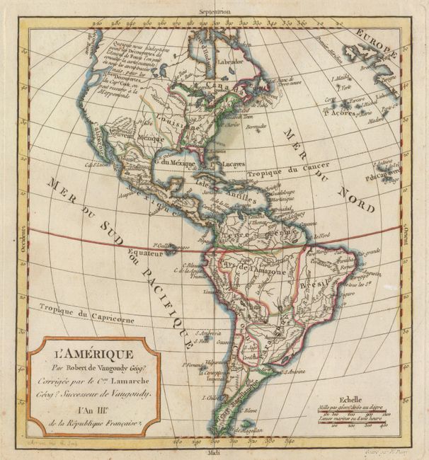
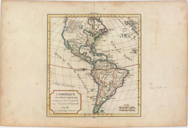
Subject: Western Hemisphere - America

Period: 1795 (circa)

Publication:

Color: Hand Color

Size:
8.8 x 9.4 inches
22.4 x 23.9 cm
Download High Resolution Image
(or just click on image to launch the Zoom viewer)

This handsome small map of the Americas is based on Robert de Vaugondy's map of the same title (1762). The western coast of North America is truncated with a partial coastline and a notation indicating a possible Northwest Passage per the supposed discoveries of Admiral de Fonte. In an update from the Robert de Vaugondy original, Captain Cook's new discoveries in the Pacific Northwest are noted as well. The British Colonies are confined east of the Mississippi River. Engraved by E. Dussy.

References:

Condition: B+

Light scattered foxing primarily in the blank margins.

Estimate: $150 - $180

Sold for: $75

Closed on 11/19/2014

Archived