Subject: Japan
Period: 1728 (circa)
Publication: Hedendaegsche Historie…
Color: Hand Color
Size:
13 x 9.9 inches
33 x 25.1 cm
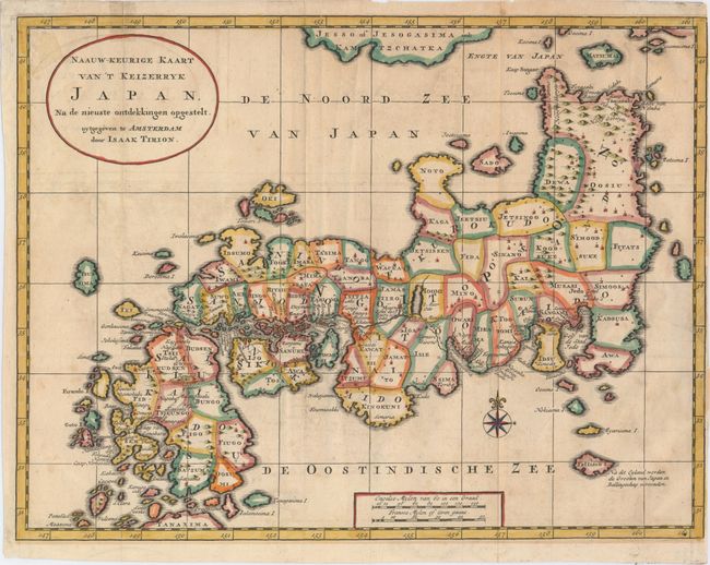
This map appeared just one year after the Kaempfer/Scheuchzer map appeared in Kaempfer's book on Japan. In the upper part of the map Jesso of Jesogasima ook Kamtzchatka is shown north of the Noto Peninsula. At the map's lower edge the tip of one of the Ryukyu islands is labeled Tanaxima. The route of the Dutch expedition between Nagasaki and Edo is shown. This version of the Kaempfer/Scheuchzer map was very influential, being published in several languages. It also served as the model for the miniature version of the map in Kaempfer's later edition of 1732 and 1749.
References: Walter #78/OAG-77.
Condition: B+
Issued folding on watermarked paper with faint offsetting, a few minute worm holes only visible when held to light, and a binding trim at right almost to neatline. Two tears that enter about 1/2" into map have been archivally repaired.