Subject: Holy Land
Period: 1618 (published)
Publication: Theatrum Geographiae Veteris
Color: Hand Color
Size:
19.6 x 14.1 inches
49.8 x 35.8 cm
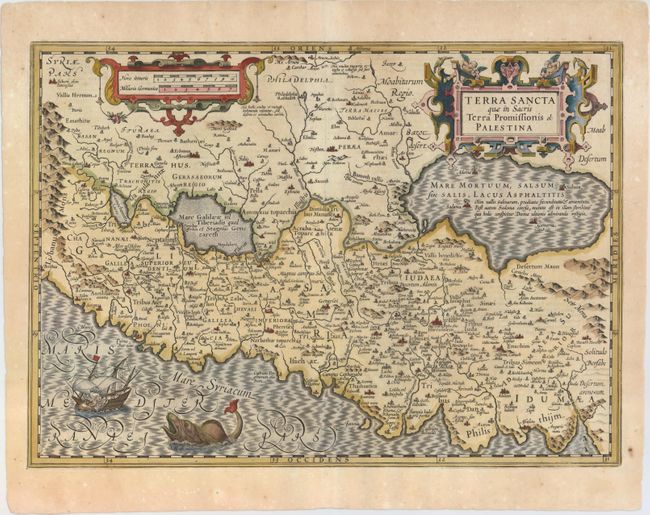
East is at the top of this striking map of the Holy Land. The land is shown divided into the Twelve Tribes and is centered on Samaria. This map is based on Ortelius' map of the region from 1570, which in turn was based on Peter Laicksteen's wall map describing his 1566 visit to the Holy Land. The Dead Sea has four cities shown burning within it: Sodoma, Gomorra, Adama and Seboim. The Mediterranean Sea is enlivened with a depiction of Jonah being cast out of the ship and into the waiting jaws of the whale. The map is adorned with two strapwork cartouches. Latin text on verso.
References: Laor #494; Van der Krogt (Vol. I) #8150:1A.
Condition: A
A fine impression with attractive color and a number of small worm holes and tracks that have been professionally repaired with a minute amount of image replaced in facsimile.